

11 Interesting Facts About Great Australian Bight
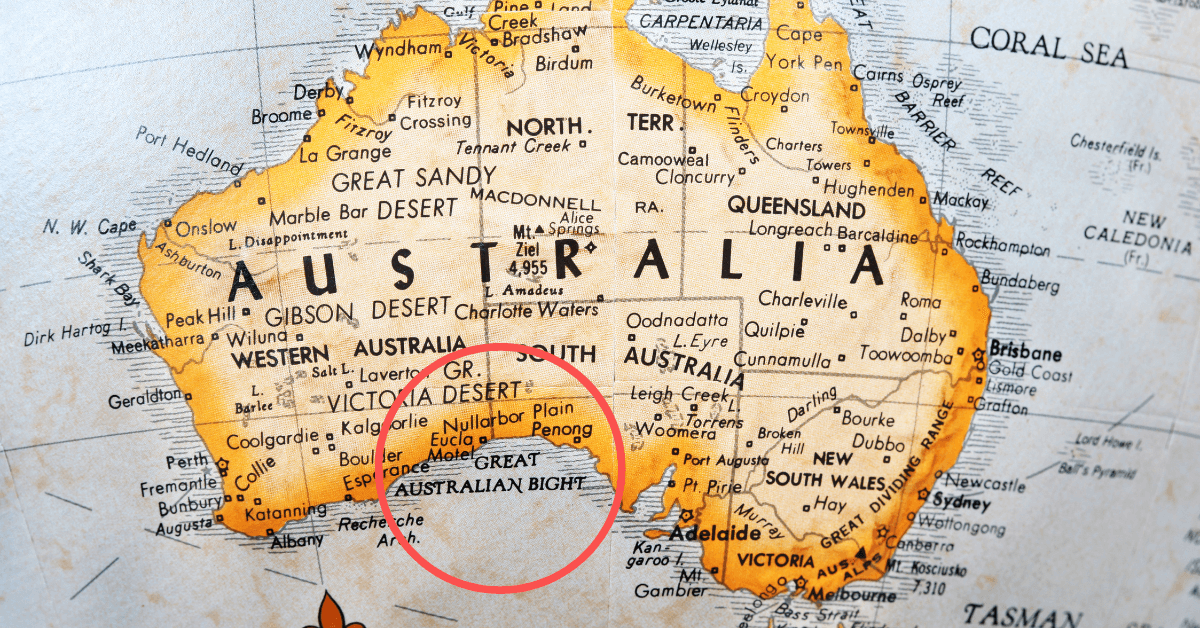
The Great Australian Bight is an oceanic bight, or a wide embayment, that runs along the southern coastline of Australia. It covers an area of around 45,926 km2 and has a depth ranging from 15 to 6000 m.
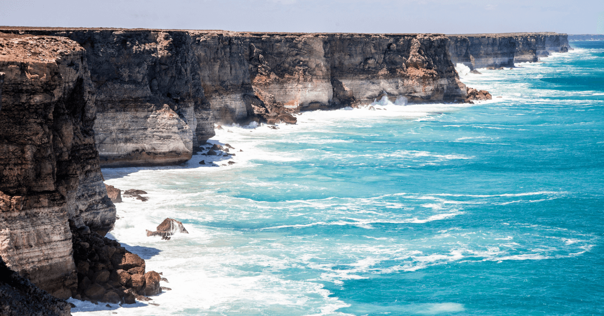
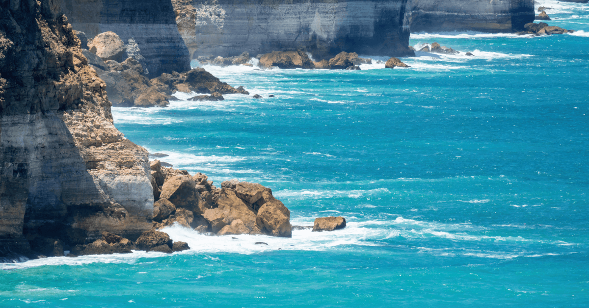
It is usually considered a part of the Indian Ocean; however, the Australian Hydrographic Service classifies it as a part of the Southern Ocean. The coastline is marked by cliff faces and rocky capes, making it perfect for whale watching.
A Bight is a broad and shallow bay or a bend in a coastline, river, or cliff. It is different from sounds as they are much deeper.
Read along to learn 11 interesting facts about the Great Australian Bight.
How was the Great Australian Bight formed?
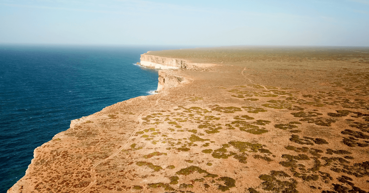
The Great Australian Bight was created around 50 million years ago when Antarctica separated from Australia. The Nullarbor Plain, which dominates the coastline of the Bight, was a seabed millions of years ago. It is made of limestone bedrock, eroded to create cliff faces.
The plain lies in an arid and semi-arid region and provides almost zero runoff and terrestrial nutrients to the Great Australian Bight, which gets most of the nutrients for its marine life from the seasonal upwelling of ocean water around the Eyre Peninsula.
Upwelling occurs, especially in autumn and summer. It fuses nutrients into the Bight and makes it more ecologically productive. The nutrient-rich water enables marine species to thrive in the bay, which is known to house around 85 endemic species.
Though rough estimates exist, the total number of species that live and those that migrate to the Bight are yet to be determined. However, it is a critical habitat for two endangered marine mammals that require conservation. These are the southern right whale and the Australian sea lion.
The Head of the Great Australian Bight witnesses many southern right whales during winter, and Australian sea lions breed near the cliffs.
A part of the Great Australian Bight Marine Park
This marine protected area is situated in the Great Australian Bight south of Southern Australia in waters within the Australian Exclusive Economic Zone.
The Marine Park has three zones: a marine national park zone covering around 7728 square kilometres, a multiple-use zone covering 22,682 km2 and a special purpose zone which occupies three separate areas of ocean covering 5991 square miles or 15,516 km2.
The Marine Park was made to protect the habitat used for calving by the Southern right whale as a feeding area for species like the sperm whale, Australian sea lions, short-tailed shearwater and the great white shark.
It is a part of the Australian Marine Parks group called the South-West Marine Parks Network. It also comes under the marine protected areas in waters within the Australian and South Australian jurisdictions within the Bight, which were together known as the Great Australian Bight Marine Park till 2005.
Charted by Navigator Matthew Flinders in 1802
For around 40,000 years, the Aboriginal people of Australia, especially the Wangal and Spinifex, hunted and lived along the Bight’s coastline and the Nullarbor Plains.
Europeans encountered the Great Australian Bight in the 1600s. It was also charted by Mathew Flinders, a British Navigator and Cartographer. He was involved in several voyages of discovery undertaken between 1790 and 1803. The most famous among them is his circumnavigation of Australia.
When he was on his way to Britain, the French Governor of Isle de France, or Mauritius, arrested him. France and Britain were at war; however, Flinders thought that the scientific nature of his work would allow him to be released. This did not happen, and he remained in custody for six years. During this period, he wrote extensively about his voyages, hoping to publish them.
His health deteriorated, and though he could finally return to Britain in 1810, he could not see the appreciation his book ‘ A Voyage to Terra Australis’ received.
Later, the land explorer Edward John Eyre conducted a land-based survey of the region. He explored Australia and was also the governor of Jamaica.
AHS Defines the bight with a smaller area
According to the Australian Hydrographic Service (AHS), the Great Australian Bight spans from Cape Pasley, Western Australia, to Cape Carnot in South Australia, which is approximately 1160 km or 720 miles. Most of the bight is situated south of the Nullarbor Plain.
Though the AHS considers the Great Australian Bight part of the Southern Ocean, outside of Australia, it is seen as part of the Indian Ocean, per the International Hydrographic Organisation.
The Great Australian Bight Coastline
The region near Cape Pasley is an outcrop of the age-old crystalline rocks. Near the cape, the coast curves and an escarpment runs parallel to it. Between the escarpment lies the Israelite Plain, here known as Wylie Scarp. Near the shore lie lagoons and coastal dunes.
The escarpment touches the shore as the coast bends eastwards, forming the 200 km-long Baxter Cliffs. As the escarpment curves again near Cocklebiddy, the Roe Plains can be seen, extending 300 km along the coast and reaching 35 km inland at their broadest point. Here, one can find dune fields, some vegetation, shrubland, and mallee woodland.
The escarpment nears the coast again at the border of Western and Southern Australia. Here, Bunda Cliffs span 220 km to the head of the Great Australian Bight.
At the Bight’s head, the escarpment bends inland. The shoreline of the western Eyre Peninsula is characterised by bays, islands, rocky capes and islands such as the Nuyts Archipelago, Fowlers Bay, Streaky Bay and so on. The coastline is made of aeolianite limestone eroded by waves and currents.
Perfect place for whale watching
The Great Australian Bight is a perfect place for whale watching. It is a popular activity during the winter in the southern hemisphere when several southern right whales come to the region from their summer feeding grounds in the Antarctic.
Whales come to the Bight, especially to its Head, to breed and calve their young. They do not feed until they return to the Antarctic. The number of whales in this region has depleted due to the whaling industry; however, their population has somewhat recovered.
The head of the Great Australian Plain lies to the south of Nullarbor Plain
The Nullarbor Plain is characterised by a semi-arid climate. It is flat and has almost no trees. It spans Western Australia and Southern Australia and is surrounded by cliffs that reach 60 to 120 m in height. Situated on the coast of the Great Australian Bight with the Great Victoria Desert to its north, it is the biggest single exposure of limestone bedrock in the world, covering 77,000 square miles. At its broadest point, it stretches about 1100 km from east to west.
Cape Arid National Park & Nuytsland Reserve lie on its shores
The Cape Arid National Park in Western Australia lies 120 km east of Esperance. At its eastern side lies the Israelite Bay. The western part is called Duke of Orleans Bay. Its coastline is shaped by Cape Arid, a Bay called Sandy Bight and Cape Pasley further east.
The area is known for sandy beaches, rocky headlands, and granite hills stretching to the north, which join Russell Range. The park’s highest point is Tower Peak, which measures 594 m. The eastern border of the Park joins the Nuytsland Nature Reserve. Ngadju Indigenous Protected Area joins the park on the north.
Nuytsland Nature Reserve is a protected area in Western Australia. In the southwest, the reserve has the Israelite Plain, a coastal plain with beaches, sandplains, coastal lagoons, dunes and the Israelite Bay. In the middle of the reserve lies Baxter Cliffs, which are 80 m high and span 190 km along the coast.
Plants found here include heath on the western coastal plains and headlands, woodlands, and mallee, which is abundant in the east. Blue bush, eucalyptus, and shrublands also occur here. The area has been surveyed for the western ground parrot, which is native to Australia.
Has many islands like Whidbey Islands and Investigator Island
The Nuyts Archipelago lies in South Australia in the Great Australian Bight. It has around 30 islands and reefs, and those situated furthest from the coast of the Eyre Peninsula are called the Isles of St Francis. The archipelago consists of granite islands and reefs that offer breeding sites for short-tailed shearwaters and Australian sea lions.
The Recherche Archipelago, known as the Bay of Isles, comprises 105 islands. They span east to west and 50 km offshore, covering 4000 km2. The western group of islands lie near Esperance, and the eastern group lies at Israelite Bay.
The Investigator Island is an archipelago in South Australia comprising Flinders Island and five other island groups. Commander Matthew Flinders named it after HMS Investigator when he explored the region in 1802. The islands lie within the Great Australian Bight.
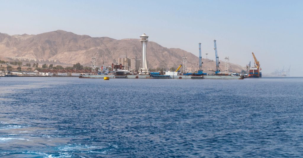
Known for fishing and shellfish industries
The Great Australian Bight was exploited for several years by the fishing, whaling, and shellfish industries. Southern bluefish tuna has been a favoured target in the Bight.
Oil and gas exploration in the Bight started in the 1960s, and oil majors like Chevron, BP, and Equinor planned to drill wells in the southern part of the area in 2017. However, in 2016, they withdrew the plans, saying they weren’t competitive and did not align with BP’s strategic aims.
The companies were also facing opposition from the community. The Wilderness Society emphasised that the worst oil leak could have a disastrous effect on Australia’s southern coastline.
How to explore the Great Australian Bight
One can explore the Great Australian Bight in many ways depending on how one prefers to travel and one’s interests. Most of the Bight is quite remote, which makes it difficult to access except for a few towns. For many people, exploring means basing oneself in one of the coastal towns like Ceduna and travelling by road or sea from there. If someone is up for a road trip, then the coastline of the Bight can enjoyed with several stops along the way.
The best way to enjoy and appreciate the marine fauna, flora, and pristine ocean environment is to explore the Great Australian Bight by ship. One can easily halt off the Eyre Highway and get a closer look at the ocean. There are also many fun activities available.
You can book fishing charters and tours to watch whales, a once-in-a-lifetime experience. Surfing and snorkelling are also available, but they are usually confined to the Bight’s eastern side around Ceduna and the Eyre Peninsula.
You might also like to read-
- 10 Interesting Bali Sea Facts
- 10 Interesting Gulf of Tomini Facts You Must Know
- 10 Flores Sea Facts You Should Know
- 4 Major Ports of Albania
- 10 Interesting SS American Star Facts
Disclaimer :
The information contained in this website is for general information purposes only. While we endeavour to keep the information up to date and correct, we make no representations or warranties of any kind, express or implied, about the completeness, accuracy, reliability, suitability or availability with respect to the website or the information, products, services, or related graphics contained on the website for any purpose. Any reliance you place on such information is therefore strictly at your own risk.
In no event will we be liable for any loss or damage including without limitation, indirect or consequential loss or damage, or any loss or damage whatsoever arising from loss of data or profits arising out of, or in connection with, the use of this website.
Do you have info to share with us ? Suggest a correction
Disclaimer :
The information contained in this website is for general information purposes only. While we endeavour to keep the information up to date and correct, we make no representations or warranties of any kind, express or implied, about the completeness, accuracy, reliability, suitability or availability with respect to the website or the information, products, services, or related graphics contained on the website for any purpose. Any reliance you place on such information is therefore strictly at your own risk.
In no event will we be liable for any loss or damage including without limitation, indirect or consequential loss or damage, or any loss or damage whatsoever arising from loss of data or profits arising out of, or in connection with, the use of this website.

About Author
Zahra is an alumna of Miranda House, University of Delhi. She is an avid writer, possessing immaculate research and editing skills. Author of several academic papers, she has also worked as a freelance writer, producing many technical, creative and marketing pieces. A true aesthete at heart, she loves books a little more than anything else.
Latest Maritime Knowledge Articles You Would Like:


Subscribe To Our Newsletters
By subscribing, you agree to our Privacy Policy and may receive occasional deal communications; you can unsubscribe anytime.